By integrating fragmented data, such as climate patterns, epidemiological records, and vector datasets, VECTRA uses proprietary algorithm to generate real-time risk maps and early-warning alerts. These tools empower health authorities and industry partners to forecast vector population shifts and proactively protect vulnerable communities.
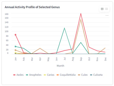
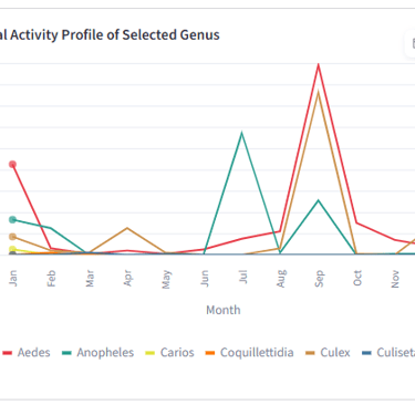
Temporal Peak Tracking
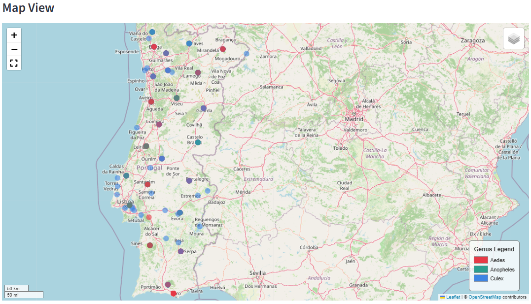
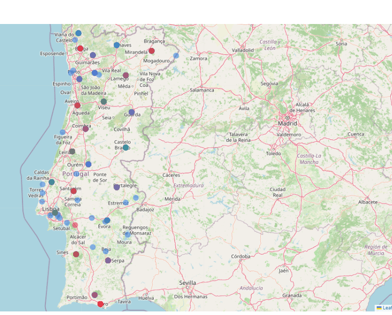
GIS-powered interface, mapping of disease vectors across the region. Users can track distribution hotspots for critical genera.
Geospatial Risk Mapping
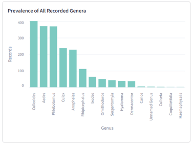
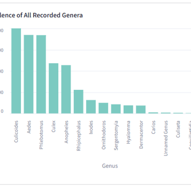
Vector Distribution Analytics
Macro-level breakdown of species density, ranking the volume of historical and active records for each identified vector.
Seasonal fluctuations and population shifts of chosen vectors month by month, mapping distinct annual spikes.
Home Projects About Contact
© 2026 Open Life Sciences
Rua Dom João De Castro Nr. 54,
Lisbon, 2801-108
Portugal
info@openlifesci.com